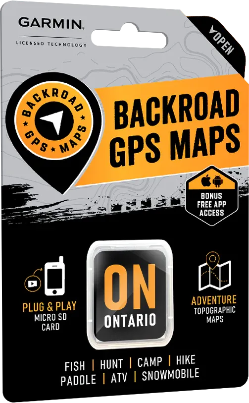
Ontario Backroad GPS Map (8GB SD Card) | Garmin Compatible Navigation
Ontario Backroad GPS Map (8GB SD Card) | Garmin Compatible Navigation is backordered and will ship as soon as it is back in stock.
Delivery and Shipping
Delivery and Shipping
United States: Free standard shipping on orders over $200.
Canada: Free standard shipping on orders over $100 to BC, AB, SK, MB, and ON
Delivery Times
Canada: 3-7 business days after processing.
**Please note**
Canada Post is currently on Strike which may delay shipping times
- We have other shipping providers available.
United States: 5-10 business days after processing.
For More information, please see our Shipping Policy
Payment & Security
Payment methods
Your payment information is processed securely. We do not store credit card details nor have access to your credit card information.
Command the Wilds of Ontario — No Cell Signal Needed
When you’re deep in Ontario’s sprawling forests, along the rugged shield rock, or tracking game across endless Crown land, reliable navigation isn’t a luxury — it’s a lifeline.
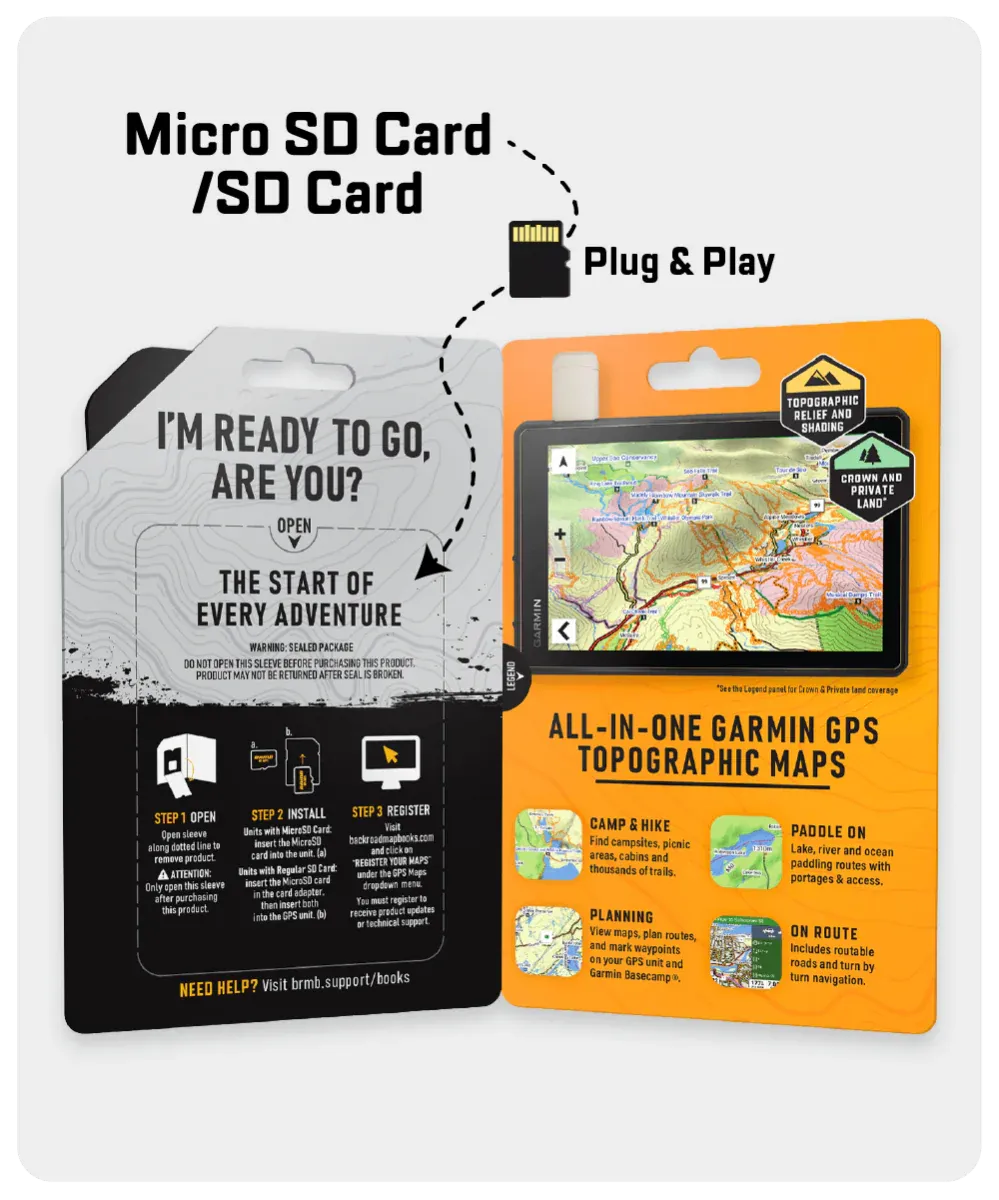
The Ontario GPS Map (8GB SD Card), built for Garmin GPS devices, fuses day-to-day navigation with advanced survival mapping, giving you total mastery over Canada’s second-largest province.
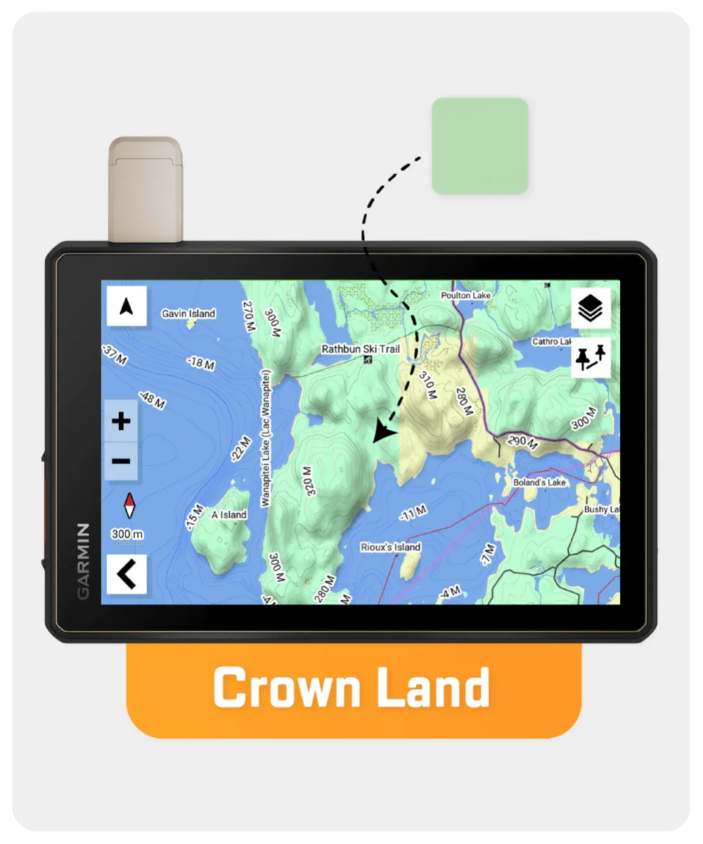
Covering over 660,000 km of backroads — with 310,000 km fully routable — this survival-ready resource also maps wildlife zones, Crown land, thousands of trails, snowmobile routes, paddling access points, fishing hotspots, and much more. Whether you’re bugging out in Algonquin, stalking moose in the north, or exploring the Great Lakes’ shores, this is the tool seasoned survivalists trust to stay ahead of the unknown.
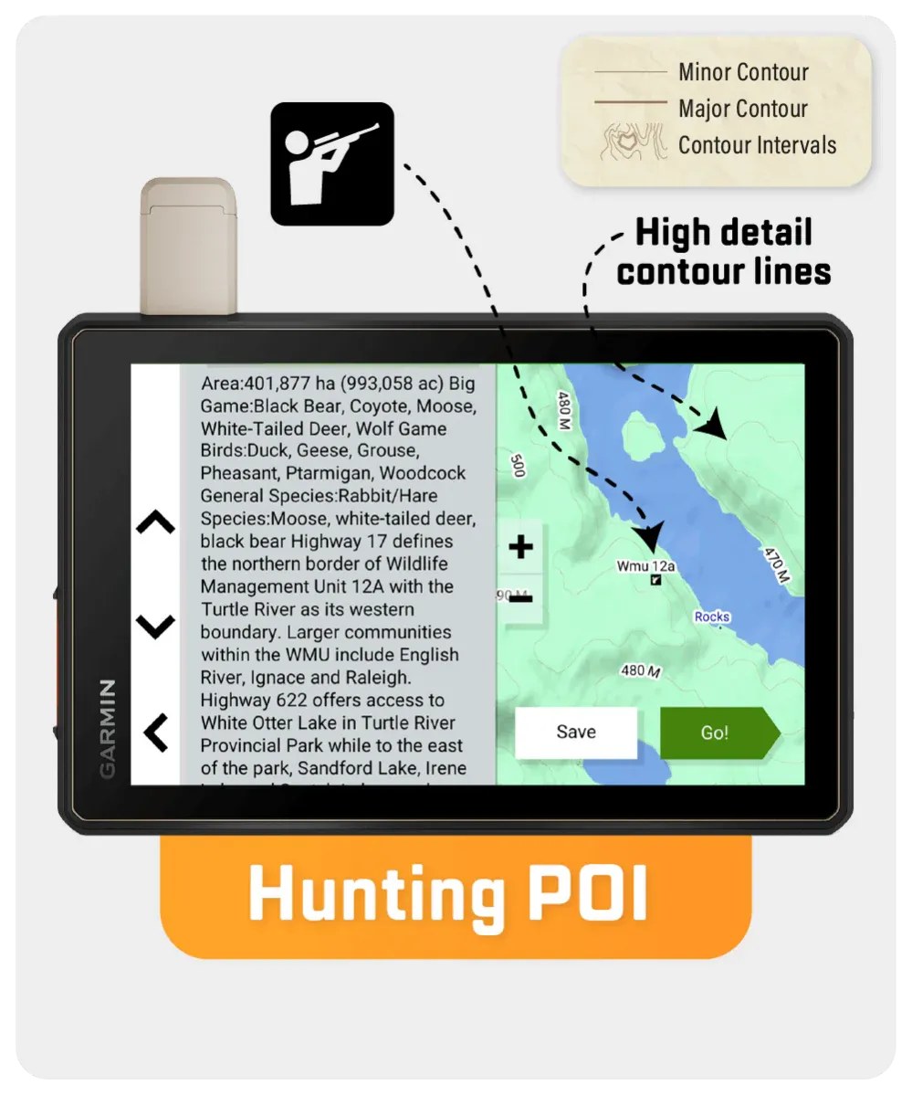
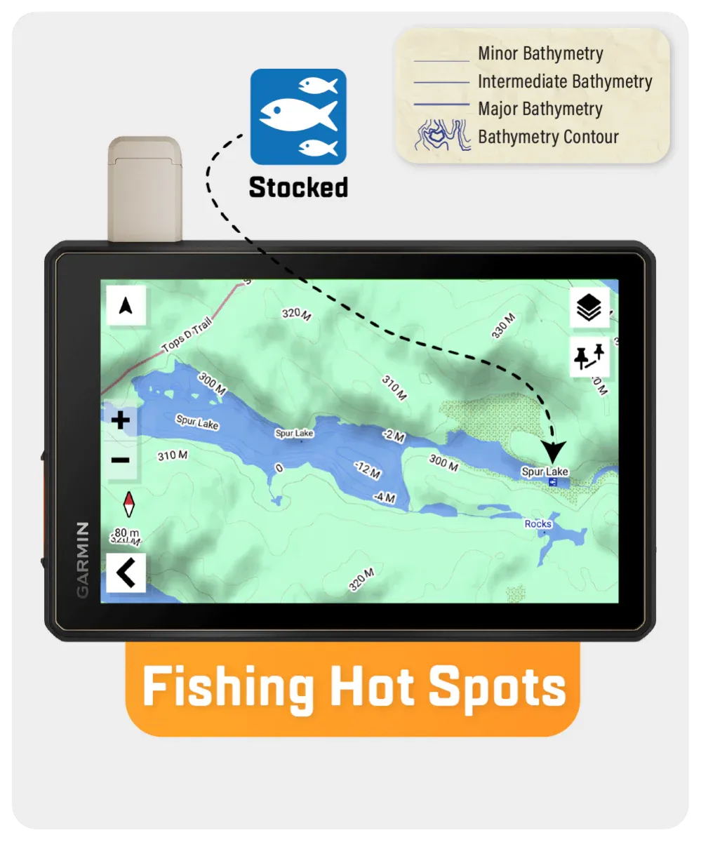
Adventure text and mapping are offered in dynamic detail, featuring bathymetric fishing contours, trailheads, First Nations reserve coverage, and conservation zones — all enhanced in the latest V2025 edition.
Key Features for Survival & Adventure:
- 660,000 km of Ontario backroads; 310,000+ km routable for precision navigation
- Clearly marked Wildlife Management Zones (WMZs) for strategic hunting
- Crown land identification for bug-out and wilderness camping
- Depth contours for 1,500+ fishing lakes, rivers, and streams
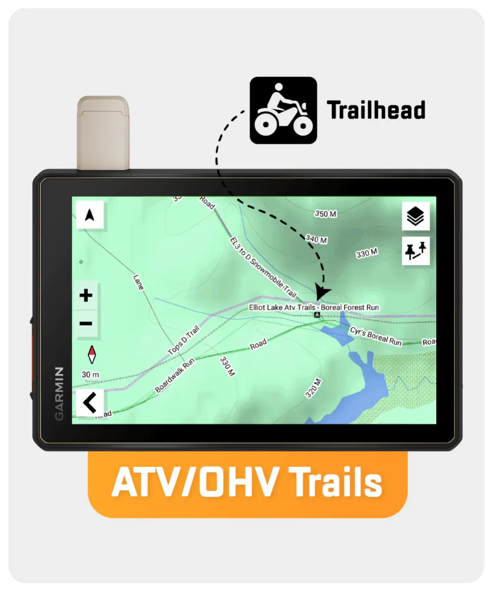
- Thousands of hiking, biking, paddling, ATV, and snowmobile trails
- Expanded motorized trails and paddling routes (latest updates for 2025)
- Over 41,000 mapped geographic land and water features
- Address search function for fast, tactical navigation
However, it’s important to note that some units may experience issues with display or feature availability, depending on the model version.
You can check if your unit is compatible here.
| Specification | Details |
|---|---|
| Map Format | 8GB SD Card (includes Micro-SD Adapter) |
| Map Scale | Dynamic Scale |
| Version | V2025 |
| Coverage | Entire Province of Ontario (plus Gatineau Park, QC) |
| Compatibility | Most Garmin GPS devices (2012 and newer) |
| Language | English Mapping Text |
| Backroad Network | 660,000+ km (310,000+ km routable) |
| Trail Coverage | Tens of thousands of km for hiking, biking, paddling, ATV, snowmobiling |
| Wildlife Management Zones | Included with species, zones, and restrictions |
| Paddling Routes | 4,000+ km |