New Brunswick & PEI Backroad Mapbook 4th Edition | BRMB
New Brunswick & PEI Backroad Mapbook 4th Edition | BRMB is backordered and will ship as soon as it is back in stock.
Delivery and Shipping
Delivery and Shipping
United States: Free standard shipping on orders over $200.
Canada: Free standard shipping on orders over $100 to BC, AB, SK, MB, and ON
Delivery Times
Canada: 3-7 business days after processing.
**Please note**
Canada Post is currently on Strike which may delay shipping times
- We have other shipping providers available.
United States: 5-10 business days after processing.
For More information, please see our Shipping Policy
Payment & Security
Payment methods
Your payment information is processed securely. We do not store credit card details nor have access to your credit card information.
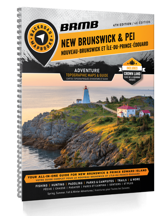
Unlock the Secrets of Canada's East Coast — Navigate Beyond the Grid
Whether you're trekking the untouched coastline of Fundy National Park, chasing wild trails through the Acadian forests, or prepping for off-grid resilience on Prince Edward Island, the New Brunswick & PEI Backroad Mapbook – 4th Edition is your ultimate tactical resource.
Designed for survivalists, hunters, anglers, paddlers, and explorers alike, this heavy-duty, spiral-bound mapbook delivers over 170,000 km of backroads and the most detailed outdoor adventure mapping available for the region.
Now updated with new multi-use trails, ATV and snowmobile routes, expanded Points of Interest, and even bonus sections for beaches, rock climbing, and surfing, this edition provides everything you need to plan, survive, and thrive across New Brunswick and PEI.
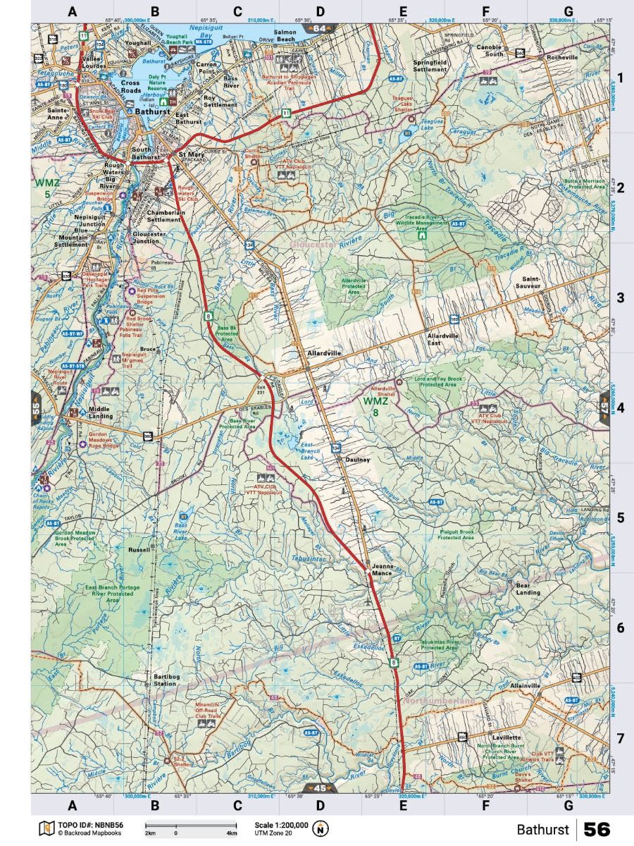
Packed with 66 detailed topographic maps at 1:200,000 scale, detailed fishing species data, refined trail systems, Crown land access points, wildlife viewing areas, and backcountry hut and cabin locations, this Mapbook ensures you are always prepared — no matter where the road (or trail) ends.
Key Features for Survival and Adventure:
- 66 detailed topographic maps at 1:200,000 scale
- Over 170,000 km of backroad and trail coverage
- New and expanded Adventure Sections: hunting, fishing, paddling, hiking, snowmobiling, ATVing
- Bonus Adventure Features: beaches, rock climbing, surfing
- Fish species added for lakes and rivers
- Wildlife viewing areas and backcountry camping sites
- Crown land, logging, and industrial road networks
- Full Service Directory and Trip Planning Tools
- Heavy-duty spiral binding for durability in the field
| Specification | Details |
|---|---|
| Edition | 4th Edition |
| Format | 21.5 x 28 cm (8.5 x 11") Spiral-Bound Print |
| Page Count | 208 Pages |
| Maps Included | 66 Topographic Maps @ 1:200,000 Scale |
| Backroad Coverage | 170,000+ km including logging and industrial roads |
| Adventure Sections | 11 Outdoor Adventure Sections + New Bonus Sections |
| Crown Land Mapping | Included |
| Additional Features | Trip Planning Tools, Service Directory, Adventure Index |