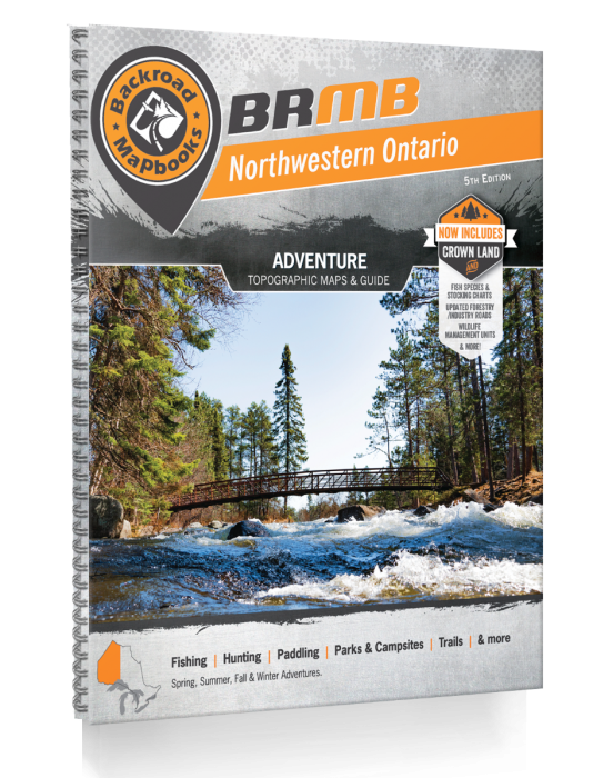
Northwestern Ontario Backroad Mapbook - 5th Edition | BRMB
Northwestern Ontario Backroad Mapbook - 5th Edition | BRMB is backordered and will ship as soon as it is back in stock.
Delivery and Shipping
Delivery and Shipping
United States: Free standard shipping on orders over $200.
Canada: Free standard shipping on orders over $100 to BC, AB, SK, MB, and ON
Delivery Times
Canada: 3-7 business days after processing.
**Please note**
Canada Post is currently on Strike which may delay shipping times
- We have other shipping providers available.
United States: 5-10 business days after processing.
For More information, please see our Shipping Policy

Payment & Security
Payment methods
Your payment information is processed securely. We do not store credit card details nor have access to your credit card information.
Navigate the Rugged Heart of Ontario — Survival Starts with Knowing the Land
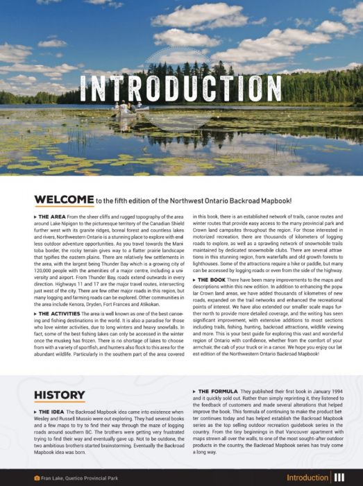
When you're off-grid in Northwestern Ontario’s sprawling wilderness — weaving through endless forests, paddling through remote waterways, or hunting across wild backcountry — precision mapping is non-negotiable.
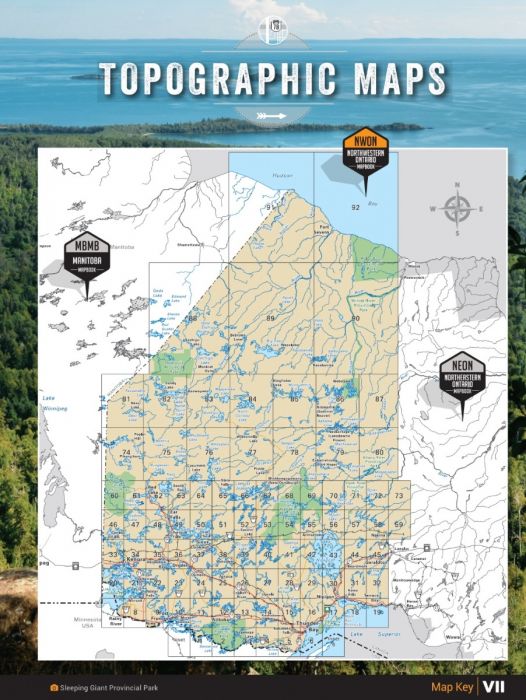
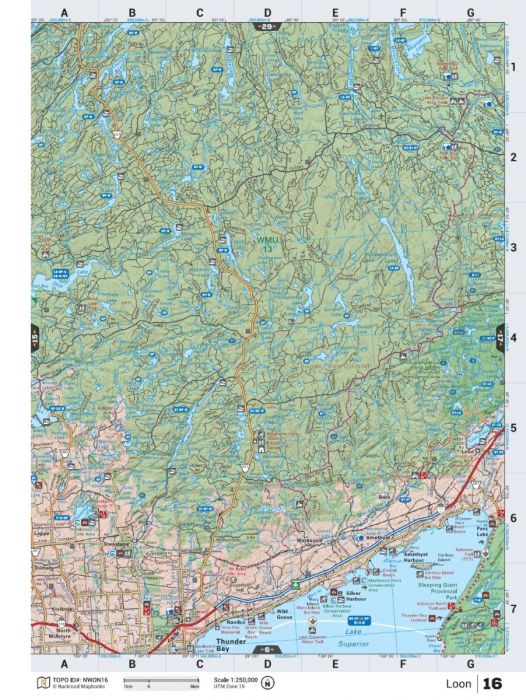
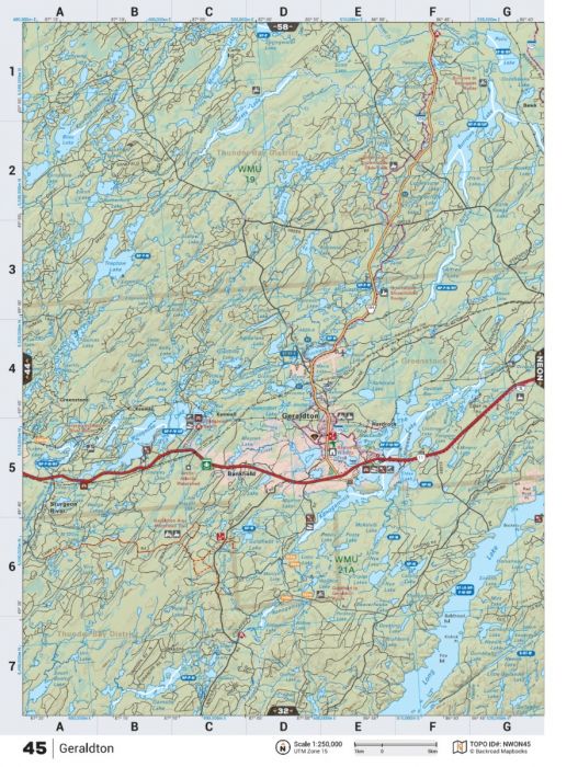
The Northwestern Ontario Backroad Mapbook – 5th Edition is your field-tested survival guide, offering detailed navigation across 145,000+ km of backroads, updated logging roads, enhanced Crown and private land overlays, and newly expanded adventure points of interest.
With 92 detailed topographic maps, thorough fish species listings, updated ATV and snowmobile trail networks, and backcountry hut and cabin information, this heavy-duty spiral-bound mapbook is built for those who choose to venture far beyond the safe and civilized.
Whether you’re scouting new hunting zones, planning a remote bug-out route, or setting off on a solo paddling expedition to Hudson Bay, this guide keeps you informed, empowered, and alive.
Key Features for Survival and Exploration:
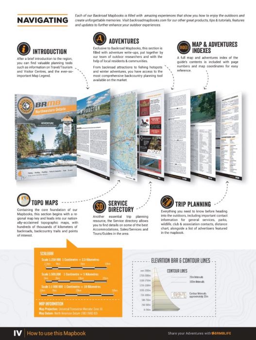
- 92 topographic maps at 1:250,000, 1:500,000, and 1:1,000,000 scales
- Over 145,000 km of mapped backroads, logging, and industrial routes
- New enhanced Crownland and private land coverage
- Expanded ATV, snowmobile, and multi-use trail systems
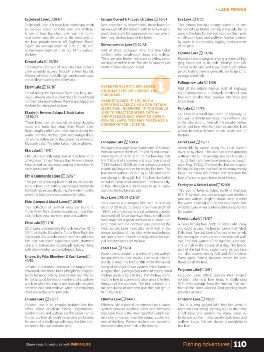
- Fish species info for lakes and rivers; updated stocking data
- Wilderness hunting zones, paddling routes, and remote campsites
- Wildlife viewing hotspots and winter recreation areas
- Durable heavy-duty spiral binding — built for harsh environments
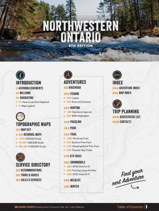
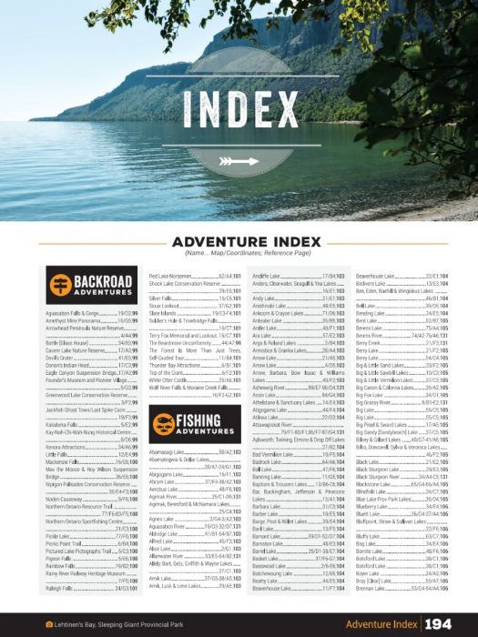
- Complete Adventure Index, Map Index, and Service Provider Directory
| Specification | Details |
|---|---|
| Edition | 5th Edition |
| Format | 21.5 x 28 cm (8.5 x 11") Spiral-Bound Print |
| Page Count | 216 Pages |
| Maps Included | 73 @ 1:250,000 scale; 14 @ 1:500,000 scale; 5 @ 1:1,000,000 scale |
| Road Coverage | 145,000+ km including logging and industrial roads |
| Adventure Sections | 10 Outdoor Adventure Sections |
| Crown and Private Land Mapping | Included |
| Additional Features | Trip Planning Tools, Service Directory, Adventure Index |