Quebec Backroad GPS Map (8GB SD Card) | Garmin Compatible Navigation
Quebec Backroad GPS Map (8GB SD Card) | Garmin Compatible Navigation is backordered and will ship as soon as it is back in stock.
Delivery and Shipping
Delivery and Shipping
United States: Free standard shipping on orders over $200.
Canada: Free standard shipping on orders over $100 to BC, AB, SK, MB, and ON
Delivery Times
Canada: 3-7 business days after processing.
**Please note**
Canada Post is currently on Strike which may delay shipping times
- We have other shipping providers available.
United States: 5-10 business days after processing.
For More information, please see our Shipping Policy
Payment & Security
Payment methods
Your payment information is processed securely. We do not store credit card details nor have access to your credit card information.
Master Quebec’s Vast Wilderness — No Signal Needed
When every decision could mean survival, you need total situational awareness — no matter how remote.
The Quebec Backroad GPS Map (8GB SD Card) delivers the most detailed, survival-ready navigation tool for Canada's largest and wildest province.
Built specifically for Garmin GPS devices, this rugged map card combines 675,000 km of backroads, 85,000 land and water features, over 12,000 km of trails, hundreds of paddling routes, and thousands of camping, hunting, and fishing locations into a single, powerful resource. Whether you’re scouting secure routes across the tundra, setting up a backcountry basecamp, or tracking wildlife, this GPS map keeps you two steps ahead — even when the world around you is completely off-grid.
Adventure text and mapping available in both French and English, ensuring clarity no matter your mission.
Key Survival & Exploration Features:
- Full Quebec backroad network, including 150,000 km of routable roads
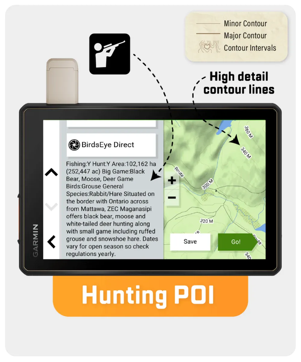
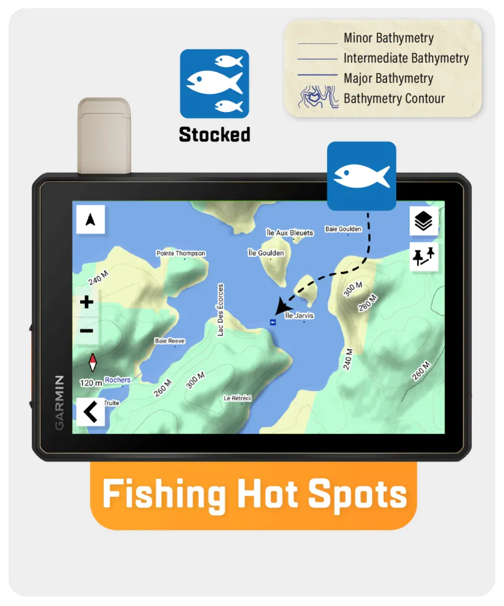
- 1,890+ fishing spots with species and stocking details
- Wildlife Management Zones for strategic hunting and tracking
- 85,000+ geographic features and 4,000+ parks and rec areas
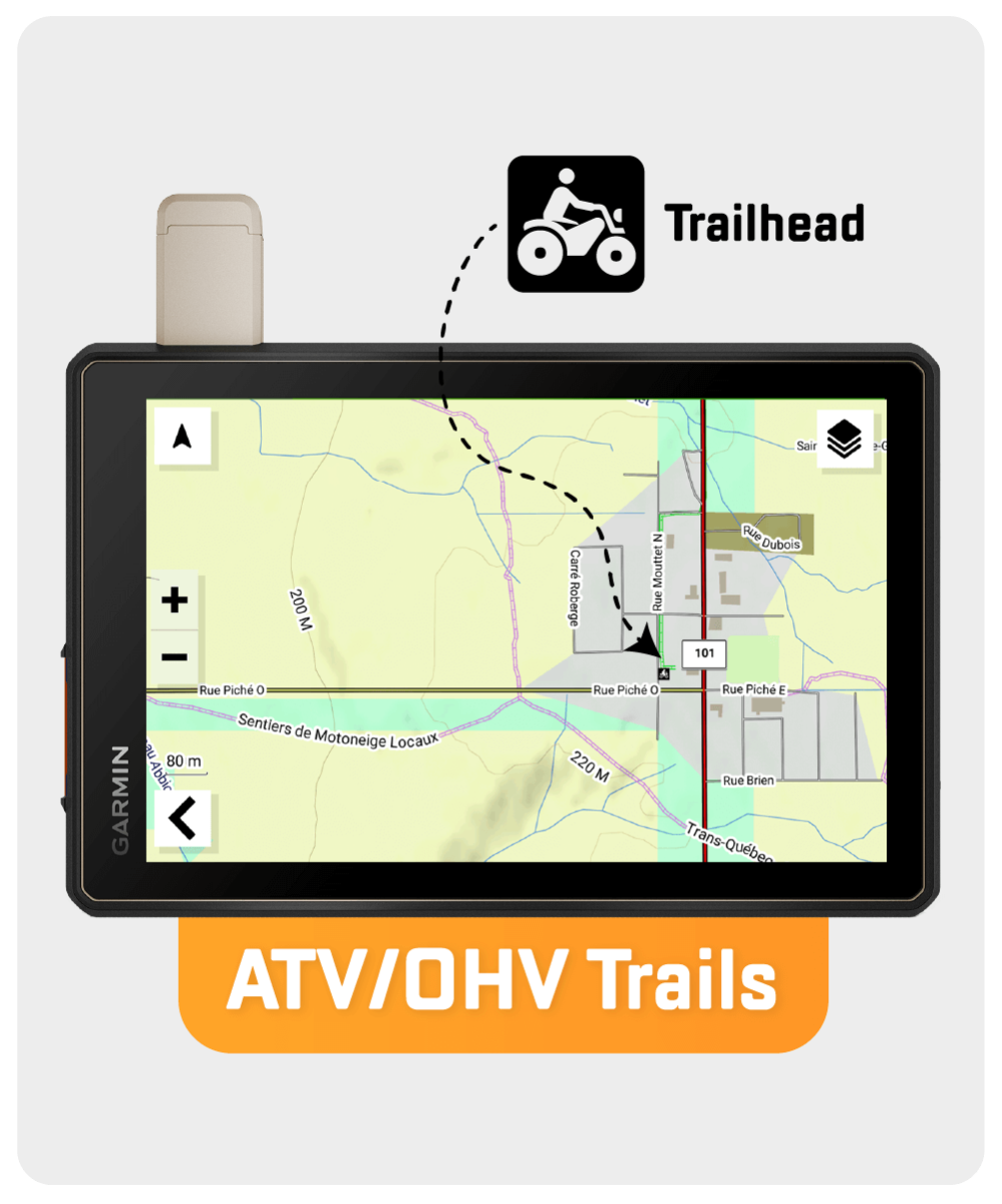
- 12,000 km of trails for hiking, biking, skiing, and snowmobiling
- 500 km of paddling routes and 2,000+ boat launches
- Hundreds of trailheads, wildlife viewing zones, and staging areas
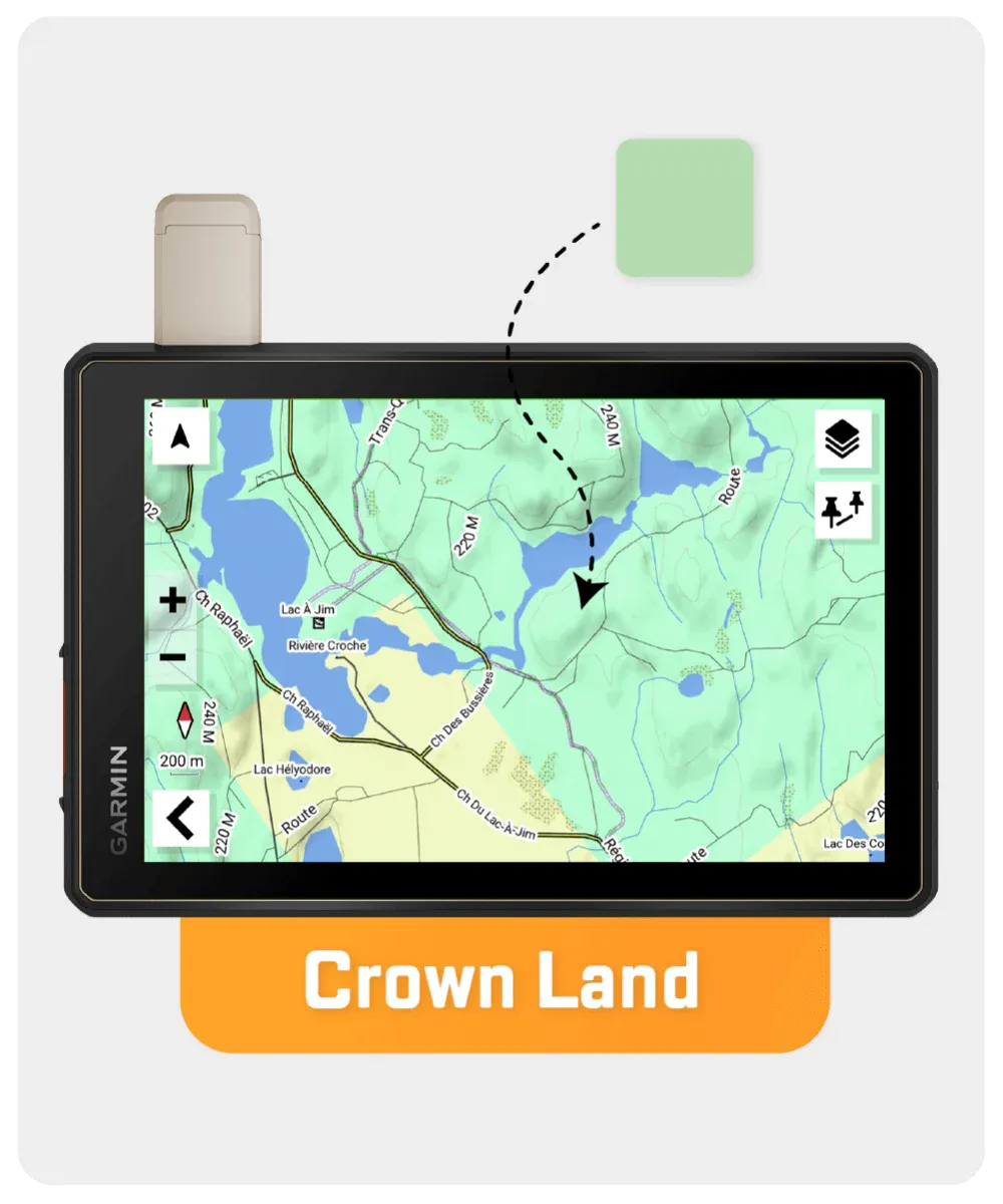
- Crownland areas identified for campers, hunters, and anglers
Stay on Course. Stay Alive. Whether you're exploring Mingan Archipelago by kayak, setting out on the tundra, or prepping for bug-out scenarios deep in Quebec’s backcountry, this Quebec Backroad GPS Map ensures you’ll never be lost, vulnerable, or unprepared.
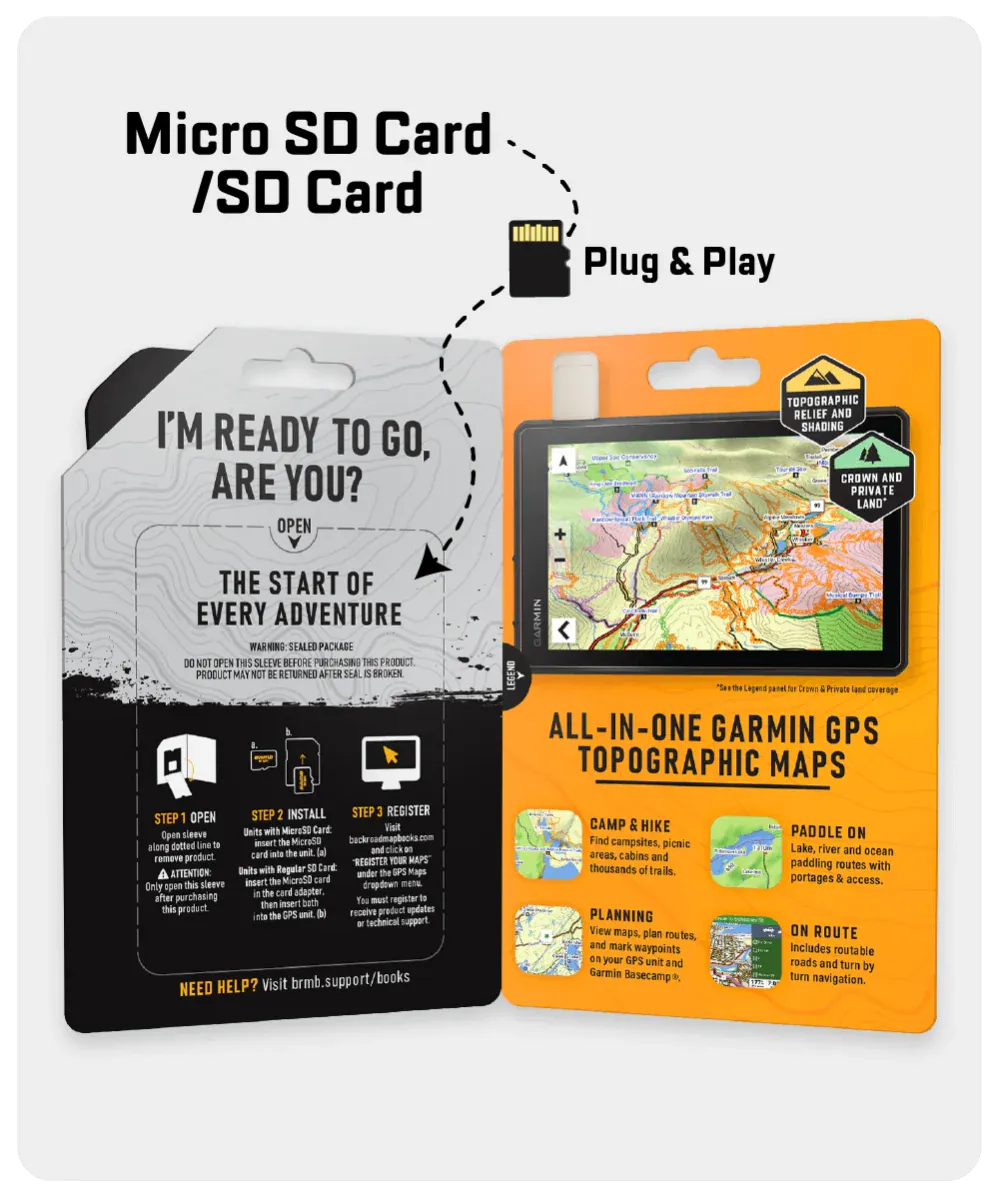
Backroad GPS Maps are designed to be compatible with most Garmin GPS Vehicle or Outdoor models made in 2012 and later that accept SD or Micro-SD cards.
However, it’s important to note that some units may experience issues with display or feature availability, depending on the model version.
You can check if your unit is compatible here.
| Specification | Details |
|---|---|
| Map Format | 8GB SD Card (includes Micro-SD Adapter) |
| Map Scale | Dynamic Scale |
| Version | V2023 |
| Coverage | Full Province of Quebec |
| Compatibility | Most Garmin GPS devices (2012 and newer) |
| Language | French and English Adventure Text |
| Backroad Network | 675,000+ km (150,000+ km routable) |
| Trail Coverage | 12,000+ km of hiking, biking, XC skiing, snowmobiling |
| Wildlife Management Zones | Included with species and restrictions info |
| Paddling Routes | 500+ km and 400+ paddling access locations |